The potential of Thermal and Archaeological Heritage through the Digital Humanities
Case studies of the promotion of rural areas*
Silvia González-Soutelo, Laura García-Juan
Abstract
§ The importance of thermal patrimony as added value for the development of rural territories
§ A treasure to be exploited: archeological and historical geodata in the framework of the Digital Humanities
§ The Digital Humanities at the service of Historical and Archaeological research: pratical cases involving the phenomenon of thermalism
§ Conclusions and future lines
The importance of Thermal Heritage as added value for the development of rural territories
Achieving an accurate understanding of the present and its dynamics can only occur when knowledge and analysis of the past is considered through a voyage from today back to yesteryear. In our case, this involved the disciplines of archaeology, geography, and history. None of these are alien to today’s world of constant change, where comprehending past reality better equips us to confront crucial global demands like the demographic challenge and the survival of rural communities and to safeguard the patrimony that has been handed down to us. In our research, instead of focusing on a single historical period we address these concerns by analysing one specific phenomenon: thermalism. This object of study is examined from diverse branches of knowledge and through distinct projects, using a multi-perspective approach that reveals the potential of existing mineral and thermal spas for catalysing rural economies.
The rural world: challenges and opportunities through the historical legacy
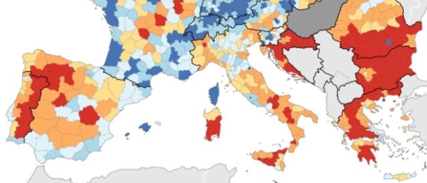
1 | Depopulation in Europe. Source: Eurostat (2020).
Any mention of the rural world transports us to scarcely-populated areas characterized economically and pre-eminently by an increasingly meagre primary sector. But this reality is actually much more heterogeneous and complex than this. Due to the so-called “demographic challenge”, society today faces a situation in which population imbalances are generating significant demands in an ever more interconnected world [Fig. 1]. In contrast to densely-populated metropolitan areas, we meet a rural world where depopulation is the great concern for society as a whole and the sphere of politics. This challenge alludes not only to low population densities, but also to poorly-distributed patterns of wealth, occupations, and exploitation that pose threats on distinct scales, including management of the cultural patrimony contained in rural areas.
Achieving the required equilibrium demands an active search for solutions that can help catalyse rural areas; that is, mechanisms that staunch demographic bleeding and, in the best cases, aid in establishing new contingents based, above all, on a younger population structure (Sáez Pérez 2021). This challenge is being taken up by researchers from diverse branches of knowledge, by public administrations, and by society itself.
We set out from a diagnosis that leads us to propose measures that often posit tourism as the main driving force, a direction by no means exempt from problems, and one that requires new strategies and proposals (Vázquez Varela, Martín Gil 2011).
Valorising tourism through research: the case of thermalism
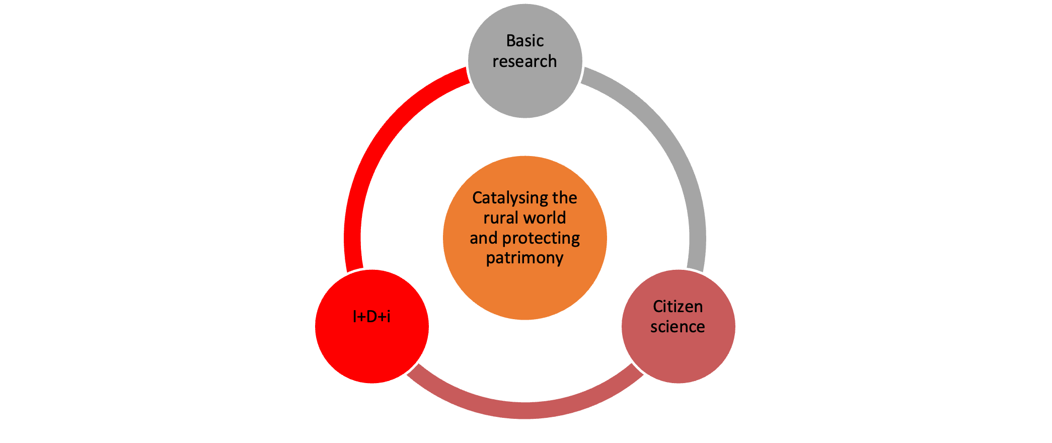
2 | Graph of the interrelation of the factors stressed in our research (elaborated by the Authors).
One result of the widespread distribution of a rich and varied natural and cultural patrimony in rural territories is that tourism has frequently been identified as the solution to the challenges that arise. It is important to understand that while tourism, in all its modalities, can operate as an active agent, it must be responsible and coherent, and help catalyse rural regions by valorising their natural and cultural patrimony. This requires achieving an equilibrium in which sustainable tourism becomes an economic motor that acts in concert with local communities. These goals have led to the emergence of proposals based on innovation and technology [Fig. 2], like “smart tourism destinations” (STD), that emphasise key concepts such as accessibility and knowledge.
To achieve these goals, tourism initiatives require novel ideas and the support of new technologies that are available to us today (López Nores et alii 2023). In this study, we argue in favour of these principles and elucidate the pressing need to transfer knowledge gained through research to social reality, based on strategies that can bind technological development to our historical and archaeological knowledge of thermal spaces.
This process refers, as well, to advances in science, while seeing people as generators of information and receivers of knowledge that will encourage them to valorise and care for their patrimony and environment. This process, called “citizen science”, is today a consolidated tendency in the conduction of important projects in which scientists work hand-in-hand with society to attain common objectives (Senabre et alii 2018). By means of this cyclical process, all the parties involved obtain mutual benefits through feedback and by generating a final product that has high cultural, social, and economic value.
UNESCO’s recent recognition of Europe’s principal spa cities as World Heritage[1] has clearly propelled the drive to centre attention on a field long exploited through wellness- and health-based tourism, but one that must also benefit from the rich historical and archaeological patrimony that characterizes it (Crecente Maseda, González Soutelo 2016; González Soutelo 2016). Indeed, beyond focusing on this resource and how it has been exploited from the traditional perspectives of health and leisure, it is imperative to ponder other tourism modalities, like those linked to cultural patrimony and the historical, archaeological, and geological wealth these enclaves present. This refers to a type of knowledge that seeks to turn to, and promote, cultural and economic products that, as occurred in past times, transform spas into catalysing agents of the surrounding territory.
Objectives and methodology
Our main objective is to elucidate a proposal that makes it possible to transform our results, and the knowledge acquired through several interdisciplinary projects in which we have participated, into a product that fosters valorising the thermal and archaeological patrimony of a region as a sustainable resource that can serve local communities. This is no simple goal, for it entails grim challenges related to both research and technology. Working in a field with a long tradition, today we seek to observe it through a novel proposal that involves acquiring large volumes of data. To do so, we employ tools that allow us to propose the pertinent consultations and hypotheses that will facilitate transforming the knowledge gathered into a product that represents a kind of purge for local communities, while simultaneously ensuring conservation of their patrimony.
The technological aspect of this methodology centres on (i) the Digital Humanities, a field that fosters cohesion among diverse disciplines, and (ii) geotechnologies that perform as protagonists in transforming the principles posited here into concrete products. With this, and our awareness of the need to create interoperable study models that endow projects with continuity and sustainability once they finalise, we advocate using free software that is easily accessible to anyone interested in the topic proposed, and elaborating standardised databases based on international norms and principles that will permit exporting and complementing the research conducted. Therefore, in addition to emphasising the potential of thermal patrimony as an exceptionally effective resource for catalysing rural areas, our work will demonstrate the growing interest in utilising these principles and tools in research projects that, through a focus on concrete themes, will allow rural territories to emerge as protagonists of their own dynamisation.
A Treasure to be exploited: Archeological and Historical Geodata in the Framework of the Digital Humanities
The concept of Digital Humanities encompasses diverse meanings, depending on the schools or countries taken as references (Russel 2011). In general, we can affirm that the Digital Humanities strive to analyse and manage the world from a perspective in which technology plays a preeminent role that goes far beyond that of a simple tool. In our work, the Digital Humanities are employed from the perspectives of archaeology and historical geography. In the concrete case of thermalism, through archaeology we strive to improve studies by moving towards an increasingly detailed, precise perspective that avoids unnecessary repetition in base research and allows to obtain greater benefits from the results of numerous projects. This, in turn, will facilitate the reutilisation and comparison of the data gathered by different researchers (González Soutelo, Romano Martín 2023, with bibliography). Together, this can lead to the creation of a product that is exportable, expandable, coherent, useful, and accessible, one that increases people’s familiarity with the archaeological patrimony associated with thermal enclaves and, hence, induces them to better valorise and enjoy those resources.
The geographical angle can enhance our perception and understanding of the territorial reality of each historical moment, and of the transformations that occurred in the past to configure existing landscapes. In this approach, emphasis is placed on historical geography, a branch of human geography whose objective is to reconstruct past societies in their context. This goal has been achieved by working with a broad range of geodata, or geohistorical sources, and digitalising them to obtain additional benefits, not only for research but also for society as a whole (García Juan, Alberto Villavicencio 2023).
Geodata, then, constitute the starting point of this initiative. Reality must be abstracted in several spatial variables that make it possible to utilise and relate various sources. In relation to thermalism, we encounter diverse sources of geodata: archaeological, medical, hydrogeological, territorial, historical, and economic, among others. This has allowed us to relate architectural evidence from Rome and from Greco-Latin texts to treatises elaborated in the 15th or 16th centuries, and to cartographic and hydrogeological descriptions that make it possible to radiograph thermalism in its geographic, political, and socioeconomic contexts and, significantly, in a diachronic manner [Fig. 2].
Without doubt, geodata, understood as a typology that associates a variable with a unique position in the territory, plays an essential role in historical studies that elucidate the knowledge and reality of a space through different prisms and over time. This affirmation makes more sense at a time when “Big Data” –the extension of GPS and other technologies that use the Internet as their channel of production and communication– increases the value of research for virtually all aspects of our everyday lives. This is another key theme of our research, though the digital Humanities pay less attention to it, especially in relation to aspects like shared use and interoperability.
To evidence the models of geodata to which we refer, we now describe three important cases from distinct historical moments. The goal is to enhance our understanding of the contexts in which those sources developed and how we can anticipate that they will increase our knowledge of territory in general, and thermalism in particular.
.png)
3 | Plan of the spa in Alange (Spain), graph scale 80 Castilian feet (1797, Fernando Rodríguez, Sg. A5949. Real Academia de Bellas Artes de San Fernando, Madrid).
4 | Image of the Peutinger Map from the Euroatlas Project.
Before the 18th century
This period offers archaeological evidence of great value for understanding territory since antiquity. The geodata gathered in the works of classic authors can be presented in a wide variety of forms that may focus, for example, on topics like toponyms, transportation routes, ancient sites, administrative delimitations, and the areas of influence of different sites, among many others. To this we must add cartographical sources like the oft-cited Peutinger Map and Antoninus Itinerary, as well as data from archaeological excavations, including iconographic and epigraphic works, to mention just a few. It is true that when evaluated from a strictly geographic perspective these data fall short of modern standards for sources of highly technical, detailed cartography, but their value is incalculable for understanding past perceptions of territory.
The same is true for both the cartography elaborated since the Renaissance and the early geographic cartography linked to various monarchies, often associated with military campaigns and expeditions, or territorial projections that allow us to control in great detail readings of territory from antiquity to modern times, understand the changes that have occurred, and fully appreciate their function and significance.
The 18th and 19th centuries
Following the aforementioned process of experimentation, this period witnessed the development of technical cartography, where knowledge of territory reached its maximum splendour. For example, authorities in Spain in the 18th century conducted an extensive fiscal verification of the territories belonging to the ancient Crown of Castile. The promoter, Marqués de la Ensenada, an important politician of the time who led several ministries, wished to know everything he could about them, so he ordered a monumental compilation of economic data that, as it turned out, had significant social, economic, and geographic components. All of this was recorded in a large number of bundles that gathered profound knowledge of territories and their peoples on distinct scales. That pioneering initiative obtained normalised data of very high quality (Camarero 2002). But this was not the only case we have from Europe, for that century was characterized by the flourishing of numerous projects that followed this philosophy of radiographing and registering contemporary reality. We also have multiple references from Italy. There, the Savoyard cadastre (land register) stands out due to the high quality and precision of its data (Alimento 2002). France is another country that provides important examples (studied in depth by Touzery 2002).
The main modality through which these projects were carried out was written sources, though as cartography developed they incorporated an important corpus of maps that steadily increased their protagonism. But whatever format was used, authors set out from drawings of the territory as the basis for improving management of the fiscal loads of each region. In that model, the documentary sources on territory considered variables that allow us to narrate the evolution not only of historical relations, but also of those between people and their surroundings.
From GIS to IDE: the great leap forward supported by technology
At the technical level, and beyond the advances in cartography mentioned above, which were of such great importance in the history of that field, we cannot speak of any other component that rivals the technological revolution of the 20th century. Around 1960, a new software came on the market in which the spatial aspect was the principal protagonist integrated to facilitate the advanced management of quantitative data; obviously, we are referring to the first “Geographic Information System” (GIS), a tool that evolved in step with advances and improvements in hardware, expanding and transforming itself into the broad series of geotechnologies we know today. Regarding geodata, normative issues began to arise in this process as attempts were made to impose order on the growing volume of information that ran the risk of being lost if no way could be found to make it interoperable. Today, thanks to initiatives by the European Union, we have the INSPIRE directive, the OGC, and numerous ISO norms, all at the international level. These measures ease the use and exchange of ever-greater volumes of data.
With respect to historical data, the uploading of archives to the Internet provides broad access to veritable treasures heretofore restricted to just a handful of researchers. One field that has benefitted greatly from this phenomenon is historical cartography, thanks to the emergence of map libraries, a visual resource generated for use with current data that has facilitated uploading these materials to networks.
Without doubt, archaeology is another discipline that has been favoured by this series of technical and conceptual developments (Pastor et alii 2013; Zamora Merchán 2016, with bibliography). The ability to accurately locate a site and its associated material culture geographically allows us to better recognise, document, and record archaeological patrimony, and model working hypotheses that make it possible to refute earlier interpretations while broadening our capacity to study, interpret, and accumulate knowledge and streamline processes like managing and disseminating the information gathered. As García-Sanjuan et alii (2018, 163) stress, GIS have spurred a fundamental methodological advance in archaeology, especially in three areas: mapping and specifying the georeferentiation of sites, combining data and focuses from distinct sources on geographic entities, and evaluating the dispersion and density of findings.
The challenge: interoperability and its application in today’s society
The main challenge confronted when working with such diverse data from the past is the need to digitalise the information. Despite the technological advances described above, this process still has some hurdles to overcome, such as elaborating interpretations while, at the same time, modelling data to give them a second life in settings for which they were not conceived. This means that digitalisation must go beyond simply scanning documents and uploading them to a network. The most important step consists in constructing large databases with information that can be applied in a complementary way in diverse fields; a goal that has not yet been achieved.
The habitual process consists in working in circumscribed spaces with a research team, or on a concrete area where technology is applied, in one way or another, to treat, store, and upload data to a network. Emerging initiatives, however, are seeking to distinguish between the digitalisation of data, per se, and the utilisation of data in concrete research. This is exemplified in the projects we describe below, which address topics that are being debated in distinct academic forums (García Juan et alii 2018); for example, the possibility of creating a model similar to the IDE using historical-archaeological information. Scepticism in this regard is generated by two issues: the ownership of data, and data quality. While more and more projects are embracing this idea, many lack a connection through which some influential international institution provides support.
The Digital Humanities at the service of Historical and Archaeological research: Pratical cases involving the Phenomenon of Thermalism
In this section, we outline the methodological proposals that, according to our accumulated experience, will allow the Digital Humanities to support the kind of transference that fosters the catalysation of local communities. To this end, we recapitulate some of the conclusions extracted from projects in which we have participated in recent years, results that nourish our shared reflections on the aspects outlined previously. Regarding the development of methodological proposals, attention in each project has focused on one concrete element that correlates with some of the critical points detected while elaborating global proposals.
Project 1 | Healing spas in Antiquity. The historical perspective of thermalism seen through classic sources
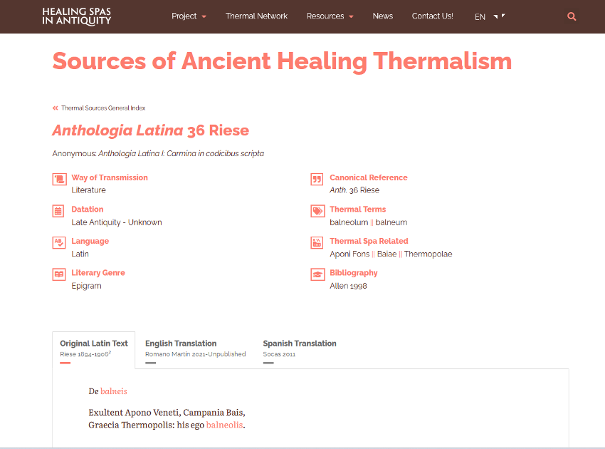
5 | Image of the database on classic sources developed on the Internet (photo by the authors).
In the framework of a Tomás y Valiente research contract at the UAM/MIAS, interest grew in creating an interdisciplinary project to identify, study, and conserve key archaeological evidence associated with a selection of thermal enclaves from across the Roman Empire. The researchers involved perceived the need to interlace the criteria and concepts related to those spaces through a bibliographic review and a process of updating the concepts and definitions required to analyse the complexes in detail. They also proposed creating a network of specialists in thermal spas from Roman times to foment international collaboration and establish a forum for debate on several aspects of their work.
Beyond proposing a channel of dissemination and encounter for researchers and others interested in this field, the website was set up to perform the labour of publicising the research undertaken in various projects, and to explore the possibility of creating working tools to facilitate exploiting the studies conducted on those sites up to the present, from distinct perspectives. Among other initiatives, this project propelled the creation of an online database where a collection of texts from Greek and Latin sources, in digital format, is accumulating. Including epigraphs, this collection offers concrete references to the phenomenon of ancient medicinal mineral thermalism. This approach made it possible, for the first time, to bring together distinct types of classic sources in one publication that facilitates analysing, comparing, and broadening existing works, while also actualising knowledge from the philological, historical, archaeological, and epigraphic perspectives (González Soutelo, Romano Martín 2023, including related and previous bibliography [Fig. 5]).
Among many other features, our proposal will allow online access to original sources for studying ancient thermalism, where the original texts (in Latin or Greek) are accompanied by rigorous translations in Spanish and English, so they can foster a critical, innovative, and continuously updated vision for the study of classic sources. This new working tool, accessible to all interested parties, will function as a living resource that provides access to primary sources, concentrates the studies conducted on this topic up to today, and allows researchers to analyse the origin of modern thermalism in greater detail and relate this to the vision of this phenomenon expressed by Greek and Roman authors.
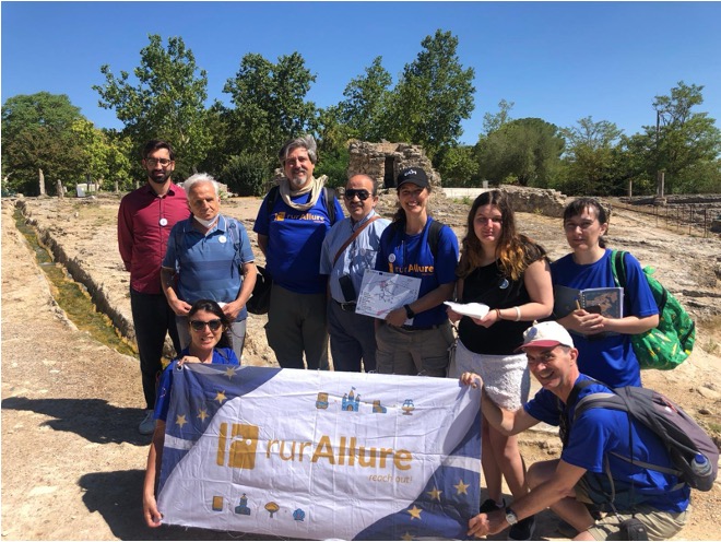
Project 2 | RurAllure: A social and economic perspective. Tools for sustainable tourism
6 | Experience of accessibility to the thermal area of Bagno Vignoni: a visit by a group of blind people (July 2022, photo by the authors).
The territorial aspect and key topics examined in this project involve broader concepts and visions. In the framework of H2020[2] European calls, this initiative developed in Europe. Entitled rurAllure: promotion of rural museums and heritage sites in the vicinity of European pilgrimage routes, its principal objective was to create tools that promote the rural patrimony which exists around several pilgrimage routes that crisscross Europe. In diverse pilot studies, researchers elaborated a series of instruments to disseminate their findings, interact with pilgrims, and foment tourism. Those tools were designed to work with distinct types of patrimony (literary, thermal, natural, and landscapes) in diverse countries and territories. Lying behind their efforts is a broad range of studies of the patrimony of rural areas close to pilgrimage routes that stress using geotechnologies to connect that patrimony with proposals for sustainable, inclusive tourism. Some of the objectives and working proposals developed in this study have earned awards that recognise member’s efforts to not only transfer the results of research but also convert them into a sustainable product designed to catalyse rural areas (Bassani et alii 2023).
Among the topics approached, thermalism carried specific weight in a pilot study designed to enhance the value of the significant thermal patrimony that exists in Tuscany, southern Italy, and along the Vía Francígena, a pilgrimage route that crosses Europe from Canterbury to Rome. This proposal, developed by specialists in the fields of archaeology, geology, and geography, procures direct contact with local realities through associations like the EAVF (European Association Via Francigena) and other colleagues and specialist of Italian Universities participating in this consortium (University of Padova and Iuav University of Venice), and with the protagonists – pilgrims – themselves. While this region is known worldwide for its history and the beauty of its landscapes[3], and is a common setting for movies and novels, it is clear that its exceptional nature reflects its isolated position in the territory and the scarce means of communication that, if expanded, would facilitate access to these spaces. These are, without doubt, aspects that must be addressed cautiously to prevent saturation and the development of destructive forms of tourism that would rob the territory of its essence.
One element analysed in relation to enhancing the value of tourism involved developing activities of an inclusive [Fig. 6], accessible character (González Soutelo et alii 2023) that would allow all types of people to enjoy the multiple facets of the area’s thermal patrimony, through both a diachronic vision (from Etruscan and Roman times to the present) and the natural salutary virtues that these waters have demonstrated in the many regions where they emerge. Other outstanding features of this exceptional landscape include the volcanic area that produced it and the abundance of medicinal mineral waters of diverse nature scattered across the landscape.
Clearly, this objective, added to the dynamics that led to the development of a model of knowledge and dissemination in which all agents involved in the territory participate, are two especially laudable aspects of this project. But the role of technology in achieving these goals cannot be lost from sight (López Nores et alii 2023). In this regard, of the three projects we describe, rurAllure has made the greatest contribution to this field, as members developed and tested a series of tools, among which a tourism app that transformed the research conducted into a concrete product stands out, together with various types of narratives, audios, and models of accessibility and social catalysation that constitute an excellent testing field to continue advancing along this path, while learning from both the errors committed and the achievements made.
Project 3 | Thermascape: A geographic and economic perspective from Roman times onwards based on historical and archaeological geodata
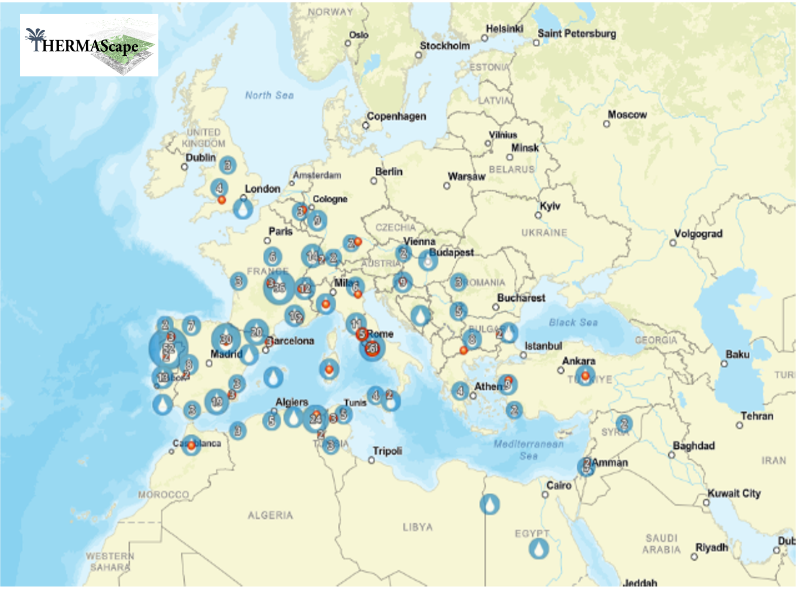
7 | Capture of THERMASCAPE visor, including a selection of thermal enclaves (González Soutelo 2019), possibly from Roman times, dispersed around the Mediterranean Sea (image by the authors).
The final project discussed[4] has its roots in the previous two, as it adopted some of their principles and advances, but also set new goals. In this sense, though the final goal was to attain a deep understanding of the establishment of baths with medicinal mineral waters from antiquity, it also considered the historical, social, and economic roles that those waters played in their respective regions, and the constructions associated with them in the evolution and formation of the territory. To achieve this, the proposal materialized in the elaboration of an extensive geohistorical database with applications that, once more, go beyond the realm of historical and archaeological research, for they strive to obtain knowledge that can aid local communities through tourism, and to implement policies for local development that benefit from the knowledge gathered.
The novel aspects of our approach consist, precisely, in measures that open the way to introducing archaeological data, for this led to the development of a model that includes a series of geohistorical sources which monitor territorial changes and water management. An added value on which work is ongoing consists in putting into motion processes linked to thermal patrimony in certain regions through sustainable tourism. For example, with the support of virtual and spatial developers, we are involved in disseminating the role that the spa at Alange has played over time. As a function of the data found in the land register, products to date include an exhibition organised with the Dirección General del Catastro in the town of Alange (Extremadura, Spain) that displays, and accentuates, the value of a past that transcends health and a concrete period to form an integral part of a historical reality that must be preserved.
The result: a proposal for making the leap from research to production
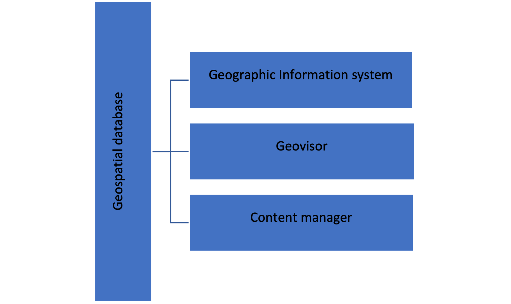
8 | Main components of the structure of the information system generated (image by the authors).
One result of the experiences outlined above is that interdisciplinary projects based on technology have been proposed, so we can affirm that the validity of this knowledge and its expansion is determined by the use of free software. This movement allows software to be utilised by any interested party, as there are virtually no impediments to access. In addition to free, open use, people can access the source code. This has facilitated the development of certain complements for managing information about the past. In this regard, increasingly consolidated and popular solutions –like the QGIS[5] project– incorporate specific complements to analyse data from the past, primarily linked to archaeology. In the independent historical and archaeological projects that we are currently carrying out, these software programs provide a common, uniform structural technique (see the graph below) that ensures viability in the development of unitary proposals [Fig. 8]. This kind of organisation also determines the fundamental parts of the methodological proposal we present.
Regarding technological components, we must clarify in relation to environments, the need to maintain a presence on the cloud to guarantee total accessibility to the network and the updating process. This has caused some problems, such as ensuring the security of archaeological data and the authorship of the layers created.
Finally, the heart of this proposal is a model of geospatial data conceived to be exploited from different research fields through distinct products that can be placed at the service of tourism-related activities.
The application developed in the rurAllure project, and the visor elaborated in Thermascape, are the best examples, for the essential features of these solutions are territory and its evolution. They offer an experience that, in relation to thermalism, goes beyond health-based tourism to emerge as a form of cultural tourism. This change in the tendency may also foment exploitation of thermal areas that do not yet have active spas, or where water management may be compromised.
Conclusions and future lines
In this paper, we set out to demonstrate how, in the heart of current society, it is important for researchers to foment dialogue and search for solutions. The so-called participative communities, founded upon the principles of solidarity and collaboration, so often involved in developing important products, must also be introduced into research. Some modalities –like projects in Europe– already demand the publication not only of results but also of the data that sustain them. We argue that working with information from the past obliges to take an additional step forward to foster the creation of spaces for the exploitation of those products. As we have shown, the benefits can be far-reaching and override any fears that may exist with respect to the quality of the results, or issues of authorship, since mechanisms exist to control this. Connecting research increases the amount of knowledge gathered, thus not only benefitting research, but also fulfilling a precept that today is institutionalised in science: transferring knowledge to society. In this case, to a specific social sector and a concrete territory: a rural world involved in a pitched battle for its survival in the context of the demographic challenge.
In all these principles, the emergence of thermalism beyond a ludic practice generates a propitious context that demands new proposals. The one elaborated in this paper is designed to enhance the value of thermalism based on the principles of sustainability and inclusiveness, two essential goals of contemporary tourism. By no means are these minor issues. At a time when water is a protagonist, eliminating this component and centring this modality of tourism on other considerations means eliminating one of the most important challenges that lurks in the background. In addition, developing proposals like the one in the rurAllure project, addresses another important challenge, one for which solutions are currently being pursued: guaranteeing an inclusive tourism in which all profiles are reflected.
The experience accumulated over the years has led us to determine that training plays a primordial role in applying the precepts espoused in this paper, and in the digital Humanities more generally. In effect, this requires professional people with the capacity to transform the reality captured in past epochs and introduce it into the present without losing its essence but transforming it into products that catalyse local communities through tourism activities. Once again, training is key. The professionals who operate in the field of the digital Humanities must receive training in technology in general and, given the spatial implications, in geotechnologies in particular. To this we must add a more transversal form of training that will facilitate dialogue and collaboration with multidisciplinary teams and society as a whole. These competencies are rarely contained in study programs, which show an increasing tendency towards microspecialisation. Thus, the Humanities, in this case the digital Humanities, hold out a promising future in which, without doubt, historical and archaeological research will play an important role in dealing with emerging challenges to society.
* This article has been carried out in the context of three research projects in which the authors of this article have participated:1) the MIAS/UAM ‘Tomás y Valiente’ project “Healing spas in Antiquity” (2018-2023); 2) the European Union’s Horizon 2020 Research and Innovation programme project rurAllure “Promotion of rural museums and heritage sites in the vicinity of European pilgrimage routes” (2021-2023), Grant agreement n. 1010048873); and 3) the Spanish National project “THERMASCAPE: El paisaje termal en Hispania. El papel de los recursos termales en la península Ibérica desde época romana / THERMASCAPE: The thermal landscape in Hispania. The role of thermal resources in the Iberian Peninsula since Roman times” (2023-2027) (PID2022-138809NB-I00).
Notes
[1] Declared World Heritage sites in 2021.
[2] rurAllure project: Promotion of rural museums and heritage sites in the vicinity of European pilgrimage routes" (2021-2023). This project has been funded by the European Union’s Horizon 2020 Research and Innovation programme.
[3] Like the Val d’Orcia Valley in Tuscany, this was declared a Natural Heritage site by the UNESCO in 2004.
[4] Data from the project entitled THERMASCAPE: El paisaje termal en Hispania. El papel de los resources termales en la península Ibérica desde época romana, PID2022-138809NB-I00 (2023-2027), leads by one of the authors of this study.
[5] According to their description: “QGIS is a user-friendly Open Source Geographic Information System (GIS) licensed under the GNU General Public License. QGIS is an official project of the Open-Source Geospatial Foundation (OSGeo)”. Accessed on 27/04/2024.
Bibliography
- Alimento 2002
A. Alimento, Los catastros del siglo XVIII, entre tradición y modernidad, “CT: Catastro” 46 (2002), 17-26. - Bassani et alii 2023
M. Bassani, M. Bergamo, S. González-Soutelo (eds.), Archaeology & pilgrimage. Studies around the rurAllure European project, “La Rivista di Engramma” 204 (luglio/agosto 2023), 7-10. - Camarero 2002
C. Camarero Bullón, El Catastro de Ensenada, 1749-1759: diez años de intenso trabajo y 80.000 volúmenes manuscritos, “CT Catastro” 46 (2002), 61-88. - Casado Neira 2019
D. Casado Neira, El patrimonio natural en villas termales de la provincia de Ourense: un camino a medio recorrer, in III Simposio Internacional de Termalismo y Calidad de Vida (SCTV-2019) / III International Symposium on Thermalism and Quality of Life. Campus da Auga (Ourense, España, 18-19 septiembre 2019), Ourense, 2019, 1-7. - Condesso 2011
F. Condesso, Desenvolvimento rural, património e turismo, “Cuadernos de desarrollo rural”, 8, 66 (2011), 197-222. - Crecente Maseda, González Soutelo 2016
M. Crecente Maseda, S. González Soutelo (eds.), Dos mil años del Balneario de Lugo: Un modelo de activación del patrimonio termal, Lugo, 2016. - García Juan et alii 2018
L. García Juan, A. Vallina Rodríguez, A. Aguilar Cuesta, Hacia una IDE para fuentes geohistóricas, “Mapping” 191 (2018), 38-47. - García Juan, Alberto Villavicencio 2023
L. García Juan, Á. Alberto Villavicencio, ¿Y después del archivo? Una mirada a las fuentes geohistóricas y su papel en el seno de la Geografía Histórica, “Estudios Geográficos” 84, 295 (2023), e148. - García-Velázquez 2023
L.M. García-Velázquez, Inteligencia Artificial y patrimonio cultural: una aproximación desde las Humanidades Digitales, “DICERE” 4 (2023), 149-160. - González Soutelo 2016
S. González Soutelo, El patrimonio arqueológico en los balnearios actuales: Revisión de una convivencia histórica y necesaria, in Libro de actas del I Congreso Internacional del Agua. Termalismo y Calidad de Vida, (Ourense, 23-24 de septiembre de 2015), Ourense, 2016. 261-277. - González Soutelo 2019
S. González Soutelo, Shall we go «Ad Aquas» ? Putting Roman healing spas on the map, “Espacio Tiempo y Forma. Serie I, Prehistoria y Arqueología” 12 (2019), 151-189. - González Soutelo, Romano Martín 2023
S. González Soutelo, S. Romano Martín, Fuentes para el estudio del termalismo antiguo: Una nueva propuesta de edición y traducción, in L. Pomer Monferrer, I. Kioridis, K. Starczewska (eds.), Traducciones de las lenguas clásicas y de los textos sagrados. Hermenéuticas y metodologías / Translations of classical languages and sacred texts. Hermeneutics and methodologies, “MonTI. Monografías de Traducción e Interpretación” 15 (2023), 179-205. - González Soutelo, Gomez-Heras, García Juan 2023
S. González Soutelo, M. Gomez-Heras, L. García Juan. Thermal heritage on the Via Francigena in Tuscany. A diachronical overview from the European rurAllure project, “La Rivista di Engramma” 204 (luglio/agosto 2023), 107-124. - López Nores et alii 2023
M. López Nores, J. Pazos, S. Reboreda Morillo, O. Penín Romero, The Horizon 2020 project rurAllure. Studying pilgrimage as slow tourism, territorial development, social cohesion, “La Rivista di Engramma” 204 (luglio/agosto 2023), 11-20. - Pastor, Murrieta Flores, García Sanjuán 2013
S. Pastor, P. Murrieta Flores, L. García Sanjuán, Los SIG en la arqueología de habla hispana: Temas, técnicas y perspectivas, in “Centro de Estudios Históricos Prof. Carlos S.A. Segreti, Comechingonia” 17, 2 (2013), 9-29. - Russell 2011
I.G. Russell, ¿Qué son las Humanidades Digitales?, “Revista Digital Universitaria” 12, 7 (2011), 68. - Sáez Pérez 2021
L.A. Sáez Pérez. Análisis de la Estrategia Nacional frente a la Despoblación en el Reto Demográfico en España, “Ager: Revista de estudios sobre despoblación y desarrollo rural” (Journal of depopulation and rural development studies) 33 (2021), 7-34. - Senabre et alii 2018
E. Senabre, N. Ferran-Ferrer, J. Perelló. Diseño participativo de experimentos de ciencia ciudadana, “Comunicar: Revista Científica de Comunicación y Educación” 26, 54 (2018), 29-38. - Touzery 2002
M. Touzery, Beyond the Pyrenees: The French Bourbons and the impossible Cadastre, “El Catastro de Ensenada 1749-1756” (2002), 67-81. - Vázquez Varela, Martín Gil 2011
C. Vázquez Varela, F. Martín Gil, Problemas de sostenibilidad del turismo rural en España, “Anales de Geografía” 31, 1 (2011), 171-194. - Zamora Merchán 2016
M. Zamora Merchán, El uso de los SIG en la arqueología española: Enfoques y planteamientos, veinte años después, in Homenaje a la profesora Concepción Blasco Bosqued, 2016, 347-359.
Mineral waters as a natural resource, together with their use and exploitation over the centuries, constitute a rich patrimony that is concentrated in rural areas due to unique hydrogeological and functional characteristics. However, the potential of thermalism phenomena has not been valued sufficiently, despite the important economic, political, and social roles they have played throughout history. This paper presents a necessary reflection on the possibilities of studying these phenomena integrally, setting out from the experiences obtained in a series of projects, and have now transformed into a proposal for the specific study outlined in these pages. We address the steps required to learn from the past, apply those lessons to current management issues, and exploit the archaeological and historical legacy of thermalism as an important catalysing agent.
keywords | Thermalism; geohistorical sources; sustainable tourism; rural catalysation.
questo numero di Engramma è a invito: la revisione dei saggi è stata affidata al comitato editoriale e all'international advisory board della rivista
Per citare questo articolo / To cite this article: S. González-Soutelo, L. García-Juan, The potential of Thermal and Archaeological Heritage through the Digital Humanities. Case studies of the promotion of rural areas, “La Rivista di Engramma” n. 214, luglio 2024, 187-204 | PDF